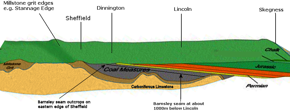
History of Coal Mining in Owlthorpe Brook Lane Opencast Mine Moorhole Colliery & How Coal is formed When dead plant matter decays into peat and is converted into coal by the heat and pressure of deep burial over millions of years. Vast deposits of coal originate in former wetlands—called coal forests—that covered much of the Earth's tropical land areas during the late Carboniferous (Pennsylvanian) and Permiantimes. The coal deposits in Owlthorpe indicate that trees and vegetation have been present in this area for millions of years. I have had a look upstream in the Ochre Dyke and found some trees that have lived and died and are in a state of decay and are in the long process of biodegrading. It seems to me that the coal that runs under Owlthorpe was originally trees and vegetation which has washed under ground by the Ochre Dyke. Geology of Coal Mining in Owlthorpe The map covers about 30 miles/ west to east, heading from the foothills of the Pennines out to the plain of Lincolnshire (via Worksop/Retford in Nottinghamshire). The Barnsley seam is at the surface in the Sheffield area, but by the time it reaches Lincoln, 40 miles to the east, it is about 0.5 mile/1000 metres below the surface. It's as though the once horizontal strata were tilted at a 1 in 20 (5%) slope, and then the highest bits sliced off like cleaving the top from a boiled egg. Reference: http://www.j31.co.uk/geology.htm
This picture illustrates the tilt of the coal measures: There are a number of coal seams running under Owlthorpe: Sitwell Thin Coal, Sitwell, Rawmarsh and Silkstone. History shows that coal in Owlthorpe has been mined by a number of pits including the Birley group of pits. Brook Lane Opencast Mine: The reference to coal at or near the surface is a direct result of coal outcrop of the Flockton (also named Chavery) seam running west to east through the middle of the Owlthorpe area. The seam dips in a northerly direction beneath Owlthorpe. As with most coal outcrops there is a high licklihood that it may been worked at some point in the past due to the easy accessibility of the coal. This is further endorsed by the fact that former Brook Lane opencast immediately to the north-west was worked over the outcrop. Dent Main Colliery; Posted By Ken Wain Copyright © 2014 "Further to my little mention of Dent Main Colliery, and the interest that is shown in the Colliery, I would like to share the following information that was given to me in a meeting with the daughter of one of the Colliery's Dirctors. Mr Brian Hutchinson went into partnership with Colin and Albert Pemberton and opened the pit in 1924.The entance to the drift was set back 100 yards from the main Birley Moor Road at the bottom of Birley Wood. The drift was driven at an incline of 1 in 3.3 into the Parkgate seam of coal. In 1945 the colliery employed 27 men underground and 11 on the surface, and at this time the manager was Mr J H Heslop. In 1947 when the mines were nationalised the N.C.B. granted the pit an operating license. Because the colliery was gas free the miners were allowed to use acetylene lamps as working lights.There were no mechanical means of coal getting, so holes were drilled into the coal face along its length, and shots were fired which brought down the coal when it was worked by pick and shovel and loaded into tubs which were of 10 cwts capacity. Pit ponies were used to transport materials to the coal face, and to bring full tubs of coal to the bottom of the drift where they were attatched to a haulage rope to be hauled to the surface by a petrol engined winch. On reaching the surface the tubs were derailed by one man using a long pole, tipping the coal onto a screening belt, the man then joined two others to sort the coal until the next tub arrived on the surface. Dent Main was one of the last pits in the Sheffield area to use ponies, they were well looked after and regularly taken to Hackenthorpe village blacksmiths to be re-shod. The pit was known locally as Diamond Row Pit because of the close proximity of a row of miners cottages, all of which had diamond design leaded windows. The workings at the colliery were always in orange coloured "Ochre Water" due to the iron deposits in the workings, the water being continually pumped from the pit. The pit was very successful and supplied the local steel works in Sheffield and the collieries own two lorries took coal to Blackburn Meadows Power Station at Meadowhall, Sheffield. Mr. Brian Hutchinson was the sole remaining director when the colliery closed in the early 1970s. He was the one who drew up the plans for the workings in all areas of the mine, great credit due to him as the only instrument available to him at the time was a hand held compass. The compass and the colliery maps are the only remaining artefacts to have survived, and are the proud possessions of his daughter, Mrs. Margaret Bennett who gave me permission to tell the story for future generations." |
|
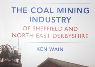
Copyright © Ken Wain 2014 In this book by Ken Wain explains about the hundereds of mines in Sheffield and Norrth Derbishire, including Dent Main Colliery (Birley WOOD) Dent Main was Granted operating licence by NCB in 1947. Dent Main Colliery was opened in 1924 and had three directors, Colin and Albert Pemberton and Brian Hutchinson. It was situated on Birly Moor Road, between Frecheville and Mosborough. |
Memories of Mining in Owlthorpe By Steve Crookes
|
Dent Main Ccollliery
|
It is believed that vast quantities of coal were extracted from the Birley Moor Pit / Dent Main colliery which was very successful and had a commercial contract to supply Blackburn Meadows power station in Sheffield . The colliery owned two 7 – ton Lorries, which took coal to the power Station on a regular basis. The Colliery also supplied the steelworks in Sheffield , the main haulers being Robinsons of Sheffield. Local coal dealers, M. Heath Jones of Intake and Keeton & Richardson, were also used for nearby small businesses and household coal sales. The drift was driven at an incline of 1 in 3.3 into the Parkgate seam of coal, which is due east from this location and also runs under Owlthorpe. In 1945 the colliery employed 27 men underground and 11 on the surface, and at this time the manager was Mr J H Heslop. In 1947 when the mines were nationalised the N.C.B. granted the pit an operating license.
As children Local residents remember going down Dent Lane to see the pit ponies that worked down Dent Main Colliery. Dent Lane is situated just behind where the fire station is now. This is part of Sheffield's
Industrial History. |
 |
Patricia Ann Turner remembers an accident where a pit pony saved her grandad's life.
|
 |
A 200ft sinkhole has been found just behind Birley Moor Garden Centre. It is believed the sinkhole may lead to Dent Main Colliery. Water had to be pumped out of the colliery into the Ochre Dyke when the collieries were open. We are looking to find out more information about the flooded Collieries that run under Owlthorpe. Has anybody got copies of the plans of the workings of the Collieries that we could print online so residents of Owlthorpe can see exactly what is happening underground? Also how is the water pumped out of the Collieries after they closed, and who is responsible. |
Julie Patterson Reply from Michael Meredith |
|
Mining at Birley Moor Pit / Dent Main Colliery continued until the late 1960s Birley Moor Pit / Dent Main Colliery https://www.mindat.org/loc-376953.html Mining at Moorhole Colliery ended in 1932
One thing that both Mines have in common is that they are situated at the side of the Ochre Dyke; water had to be constantly pumped out of both when in operation. The Ochre Dyke has its header water in Birley Woods which stands 650ft above sea level. If you follow the path of the Ochre Dyke you will see it first passes through Birley Moor Pit / Dent Main Colliery then under Moor Valley and through the culvert opposite the garden centre GPS Coordinates: 53.33822,-1.385700 then past Moorhole Colliery . After the pits were closed in the late 1960s water was no longer pumped out. It is believed that both pits are in a perminent state of flooding with water poring into the drains. In heavy rain conditions the drains can no longer cope as shown in this Video: Ochre Flooding out of Pits
|
|
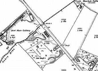
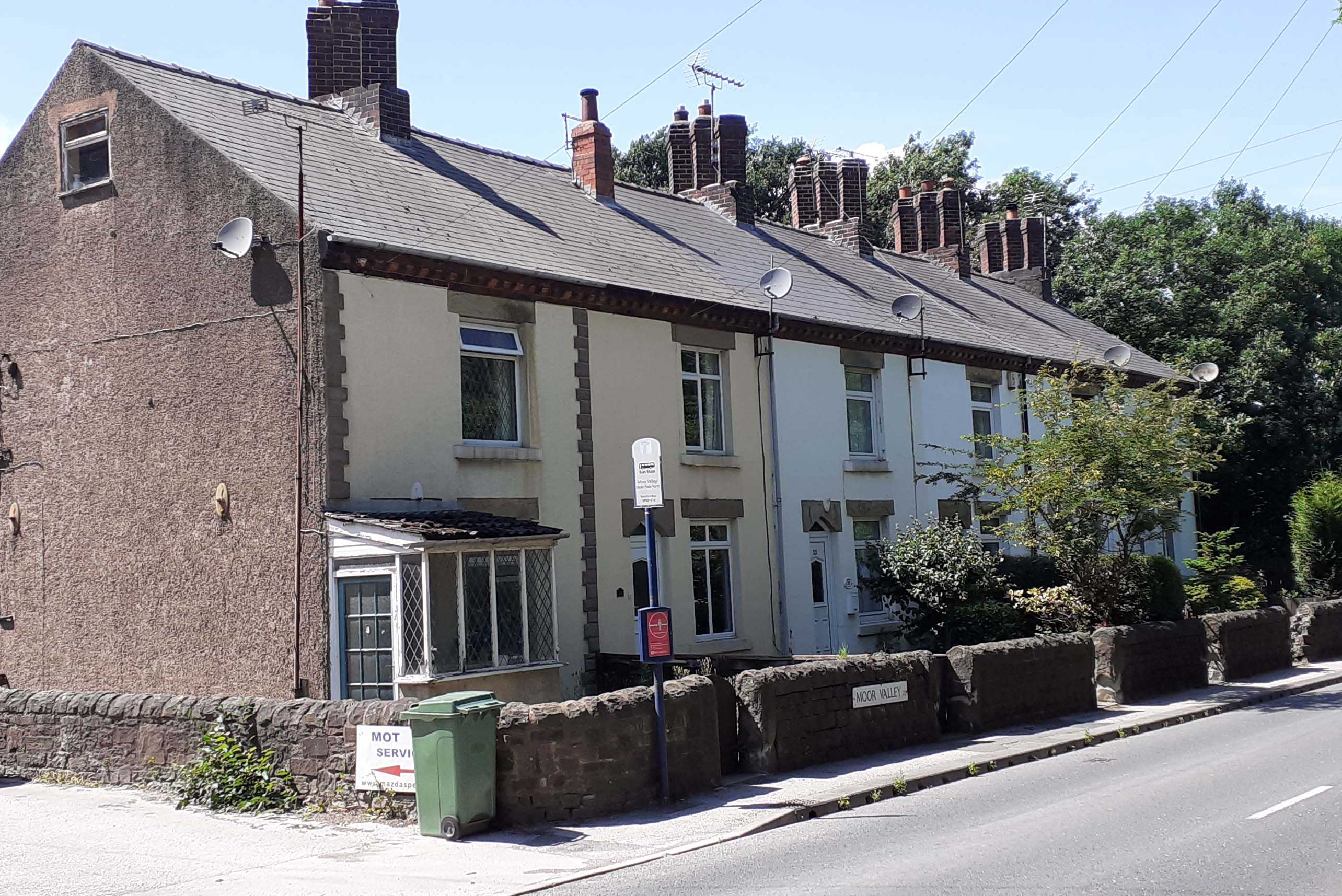
Moorhole Colliery A map dated 1875 shows the workings of the Moorhole Collieries (designated as "Old Shaft"). The winding house was set back south and west of the Diamond Cottages. To the left is a photo of Diamond Cottages as they are today. Situated in Moor Valley at Aprox: 423ft above sea level GPS Co-ordinates 53.33765,-1.38546
|
|
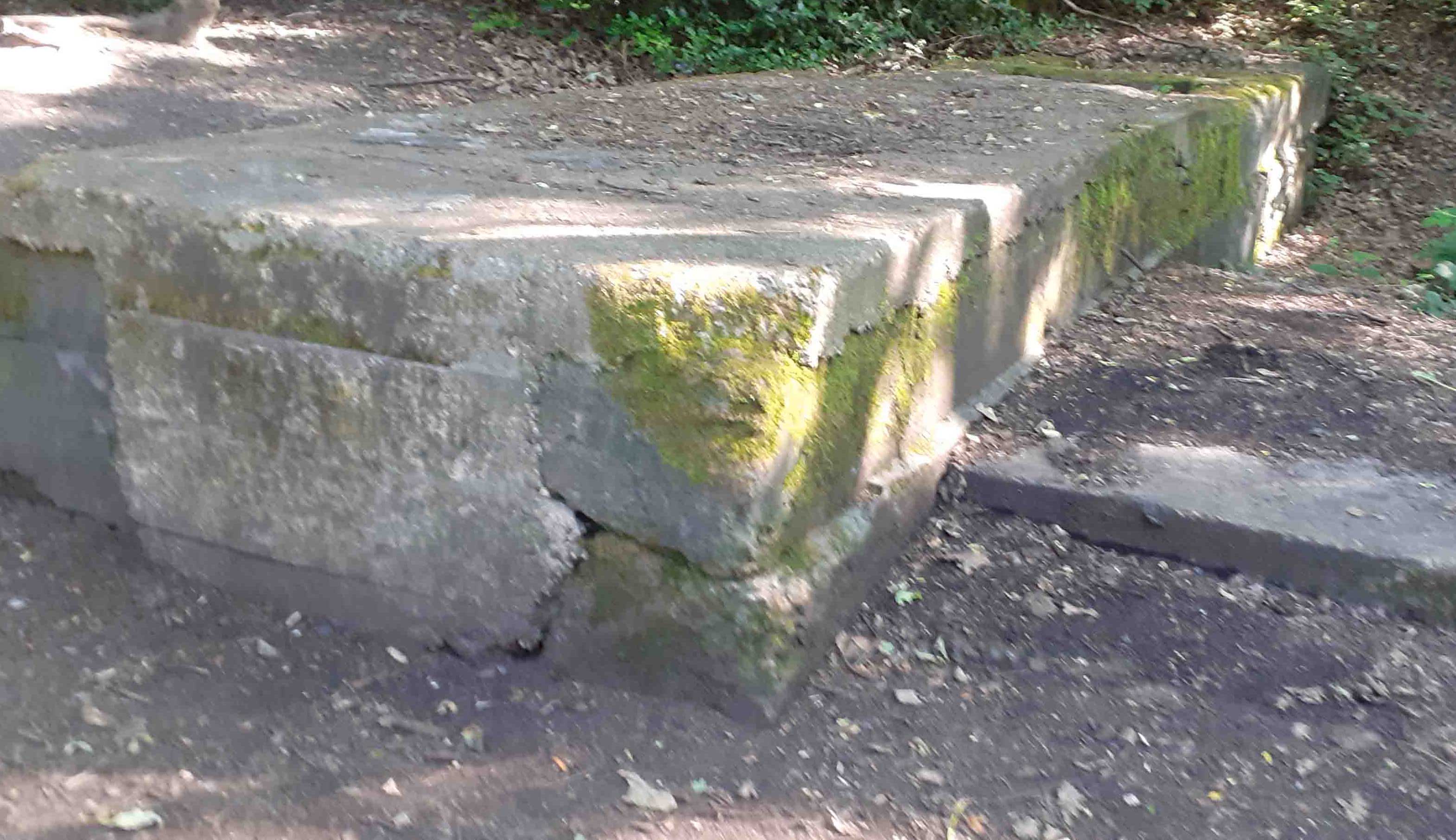
There was a tramway which ran under Moor Valley and down to the Colliery drift. The photo to the left shows the Colliery drift, now capped off and standing Approx: 384ft above sea level. GPS Co-ordinates 53.33890,-1.38101 |
|
Please read our editorial in the Yorkshire Bylines. Please help save Owlthorpe Heritage & Nature Trail by signing our petition to Sheffield City Council: https://chng.it/6vXHqcGG4S
|
|


E-Mail: ecologicalowlthorpe@gmail.com
Facebook: https://www.facebook.com/people/Ecological-Owlthorpe/100064743398782/