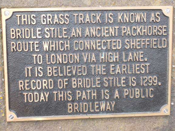
Owlthorpe History Owlthorpe is situated between Hackenthorpe and Mosborough. The area was made up of farm land & wood land that has thrived at the side of the Ochre Dyke, The Ochre Dyke runs from the header waters behind the Garden Centre https://birleymoor.co.uk/ to the river Rother in Beighton. Packhorse’s use to travel acros Owlthorpe from the smithy at Main St Hackenthorpe and continue on their trips from Sheffield to London. The earliest evidence of this is on this notice board. The bridleway is still sign posted across Owlthorepe.
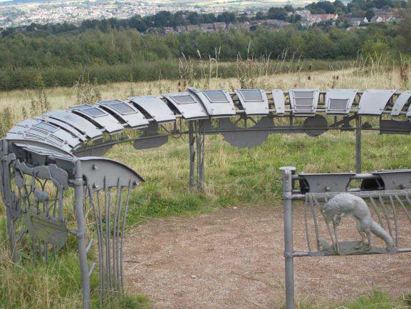
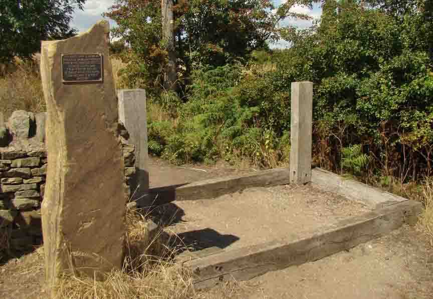
The monument to Mosborough shows that one of the predominant industries was using charcoal to make sickles and scythes for use in the farming industry. The monument has many plaques of interesting information and is well worth a visit.
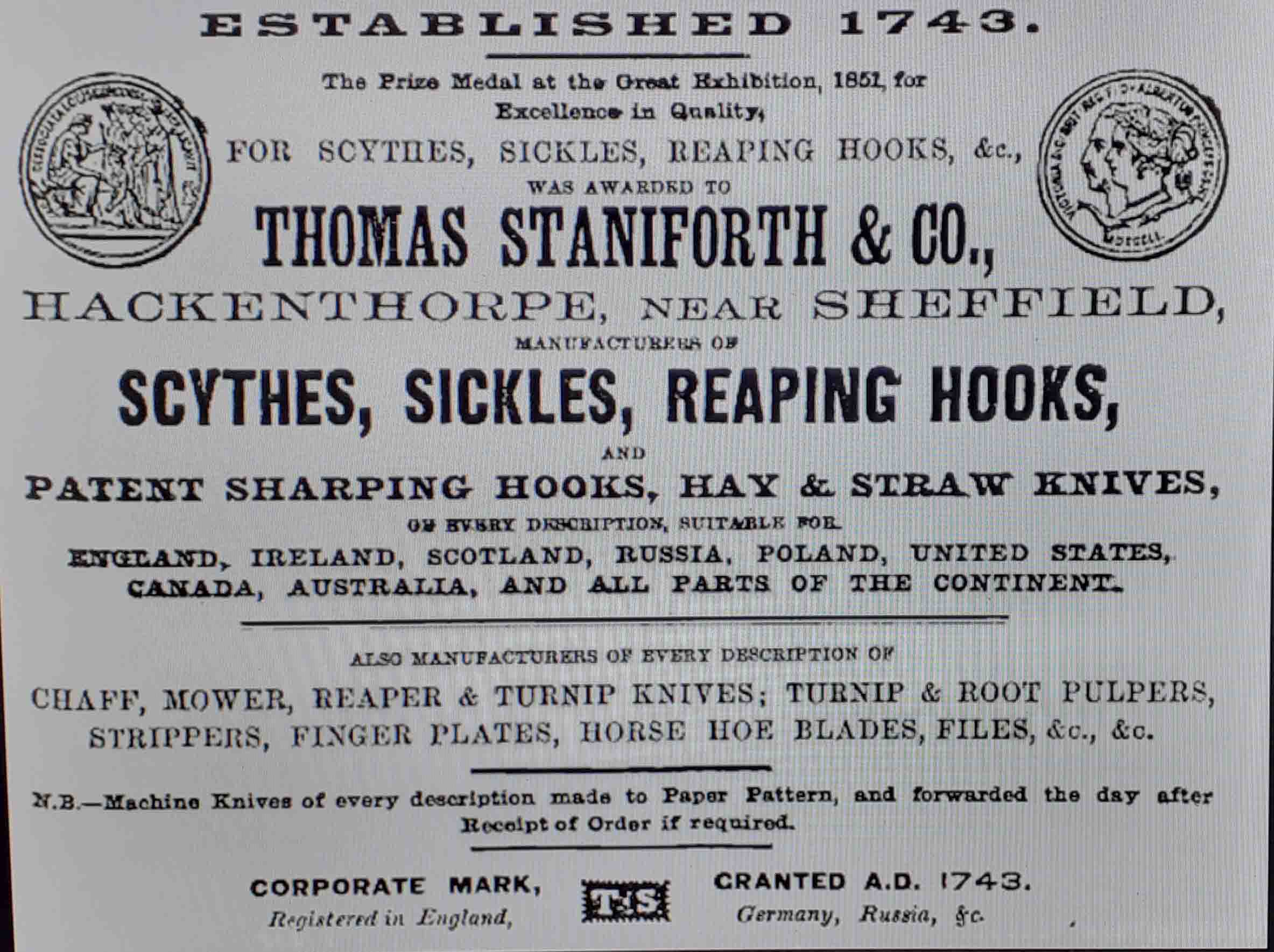
Above is the wording of an advertisement showing Thomas Staniforth won the Prize Medal at The Great Exhibition 1851, for excellence in quality. Thomas Staniforth & Co. was a sickle, scythe tool smiths based in Hackenthorpe, Sheffield, England. The company was founded by Thomas Staniforth in 1743 and operated out of workshops located on Main Street, Hackenthorpe until it was closed during the 1980s and its assets incorporated into Spear & Jackson. The company was known for its Severquick brand of gardening tools. Wood was coppiced from many trees in Owlthorpe to make charcoal used in the many kilns operated by out workers, who then transferred goods to be finished by the grinding wheels and eventually transported by pack horese to Tomas Staniforths in Main St. The finished goods where then transported across the bridal ways that run through Owlthorpe on their way to London and abroad. At the turn of the century in 1894 there was a Blacksmiths Forge, Main Street, Hackenthorpe. It was situated inside a farmyard. In the 1894 directory the only blacksmith in Hackenthorpe belonged to William Price, in 1906 it is listed as the Oades Brothers. The blacksmith must have been kept busy with work from farms and the pit ponies that worked down the mines. Moorhole Lane number 6 on Our on-line Visitor's Guide
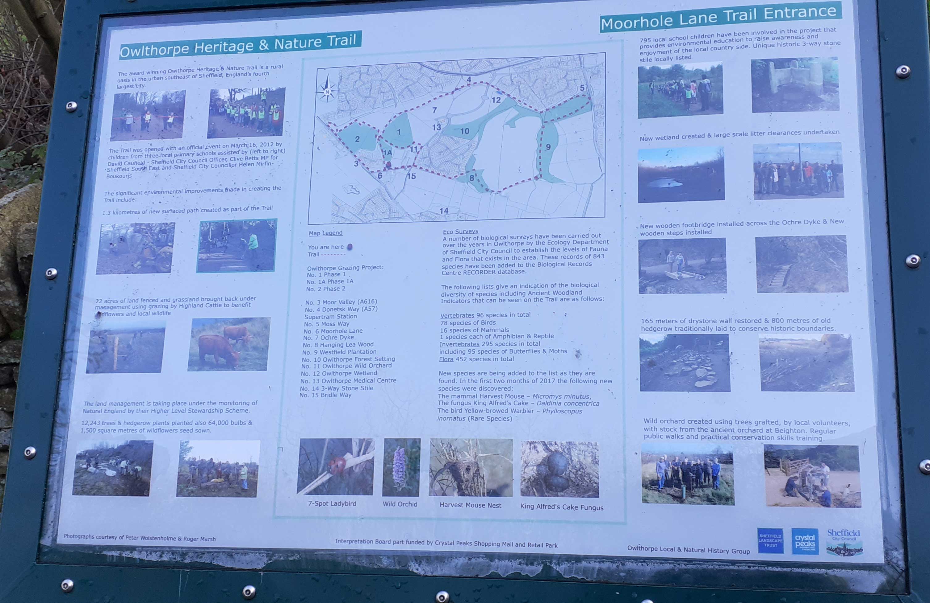
From the Notice board at the top of Moorhole Lane you can take the publice footpath to the left which leads you past the Grazing project and on through Owlthorpe Heritage & Nature Trails. If you continue down Moorhole Lane past Christmas Cottage at the bottom of Moorhole Lane you come to another notice board. At this point there are a number of Public Footpaths which you can take. If you go to the left you will come down to Owlthorpe Wild Orchard if you carry straight on this will lead to HangingLea Wood. If you take the right turn this leads up the Bridal way towards the monument.
Moorhole Farm House Moorhole Farm House was demolished 1984 approximately after John Pratt and his family moved to Spinkhill Farm. The 1881 Census shows the resident of Moorhole Farm as John Lee a farmer of 150 acres aged 39, his wife Sarah aged 30, his two sons George aged seven, Edwin aged four months and his daughter rose aged two.. He employed two labourers and a boy. Also living at the farm was Clars Rose aged 26. All of those named above are listed as being born in Eckington, Derby, England. Additionaly living at the farm was John Easten an unmarried agricultural labourer aged 20 born in Hibaldstowe, Lincoln, England. |
|
At the top of Moorhole Lane there is a Bridle Stile that leads past the Grazing project. To the right, at the bottom of Moorhole Lane the bridleway runs up to Moor Valley. Unfortunatly this part of the Bridleway is somewhat overgrown. Nearby there is an ancient Bridle Stile Standing aprox:515ft above sea level GPS Co-ordinates 53.328617,-1.374355 |
 |
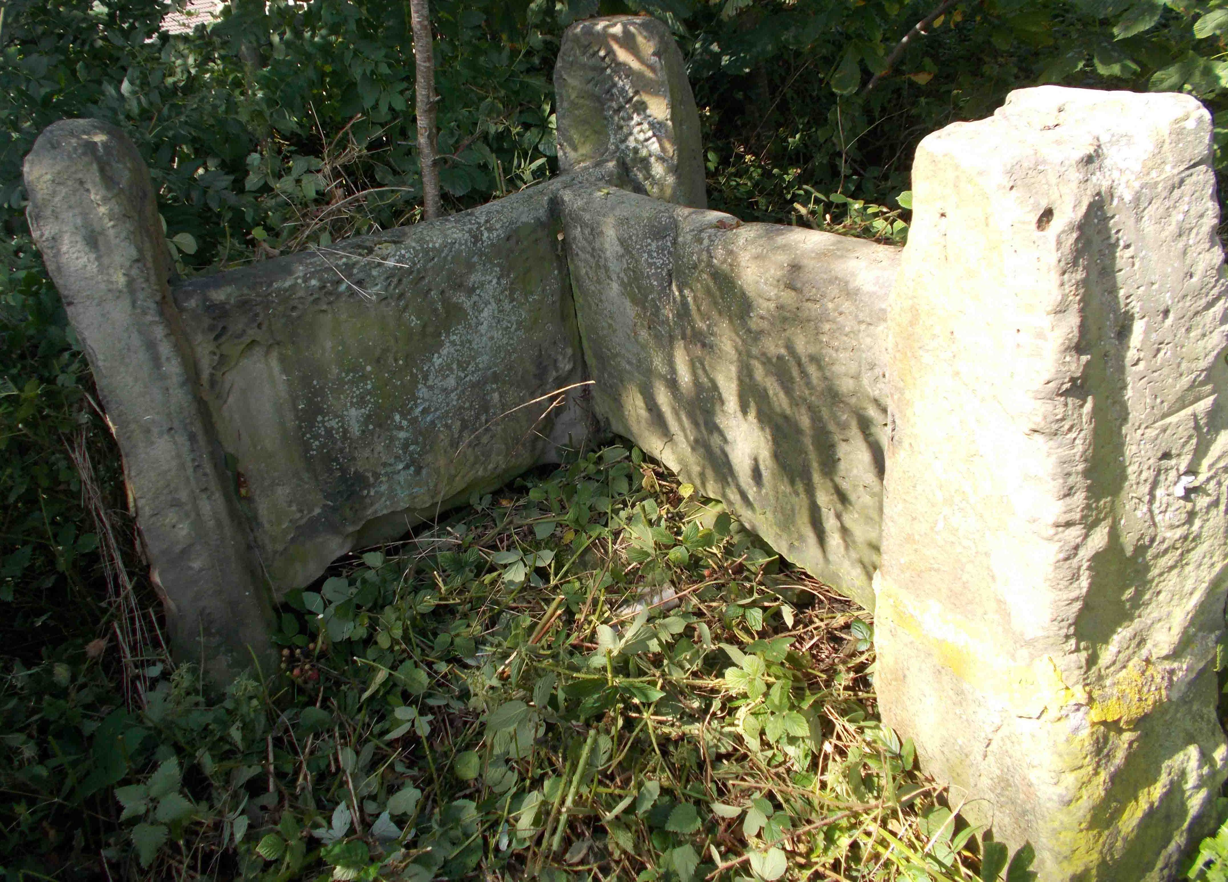 |
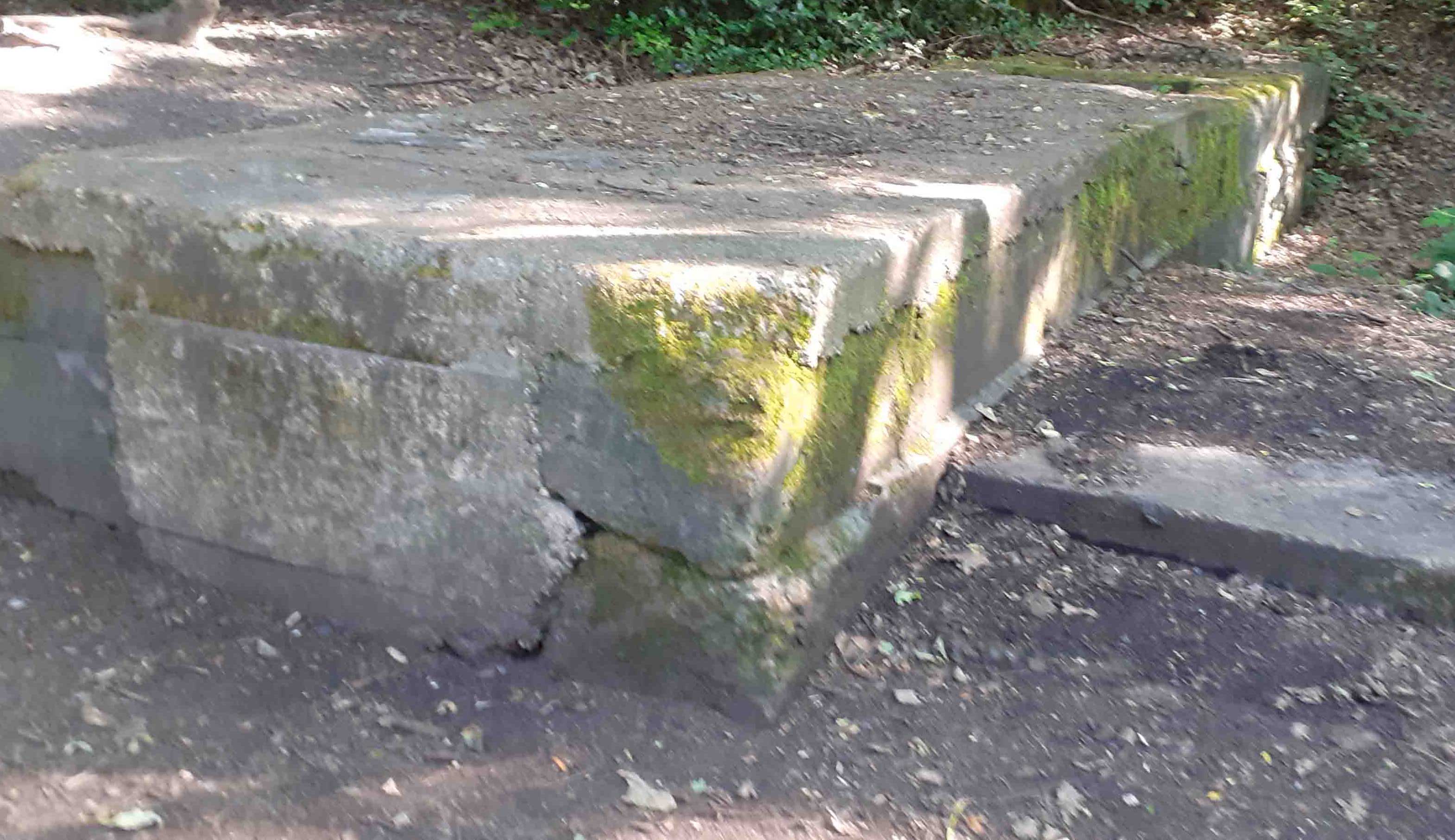
Taking a sharpe right and climbing up the farmer's field will lead you to the ancient 3way stone stile, as seen in the picutre to the left. The pit ponies were housed just behined the three way stile. They could often be seen crossing Owlthorpe on their way to the blacksmith at Hackenthorpe before going down the pits at Dent Main Colliery. Standing aprox: 502ft above sea level. GPS Co-ordinates 53.33297,-1.37559 |
History of Coal Mining in Owlthorpe Brook Lane Opencast Mine Moorhole Colliery & For more information about Coal Mining in Owlthorpe folow this link ---------------------------------------------------- Just a few metres down from the Bridle Stile stands a monument showing the history of Mosborough.
Mosborough was a settlement in the Domesday Book, in the hundred of Scarsdale and the County of Derbyshire. It had a recorded population of 13 housholds in 1086. Mosborough, Land of Ralf son of Hubert. Households: 13 freemen. Land and Resources: Ploughlands: 5 men's plough teams. Other resources Meadow 3 acres. Woodland 1.5* 1 Leagues. Owners: Tenant in chief in 1086 Ralf son of Hubert Lord in 1086 Ralf son of Hubert Lord in 1066 Leofnorth (brother of Leofric) Please read our editorial in the Yorkshire Bylines. Public Inquiry Information supporting Ecological Owlthorpe as an upstream nature based solution protecting the environment from downstream flooding. Please help save Owlthorpe Heritage & Nature Trail by signing our petition to Sheffield City Council: https://chng.it/6vXHqcGG4S also our petition to Parliamentary Ombudsman: https://chng.it/FPc7X4Nq
|
|