Introduction, My name is Michael Meredith. As a child 69 years ago i visited Owlthorpe, I played with my cusins climbing trees and catching newt ands frogs in the headerwaters of the Ochre Dyke. We were forbidden to go down Dent Lane to the pits because Aunty said it was too dangerous with many lorries carrying coal to the power station. Many girls did go to the pit to see the pit ponies working there. . Some even got to have a ride on them. My wife Gill and I move to Owlthorpe in 1990 and have enjoyed the walks by the Ochre Dyke especialy the Nature Trail Summer. The project was named Ecological Owlthorpe by Sheffield University students who studied Landscape and Architecture, and who took and intersest in the building plans submitted for the area and the local residents' objections to them. The students took an in-depth look at our oasis and the many residents’ objections to building in Owlthorpe. Although many students did not support building in Owlthorpe, at my request, they produced alternative plans which would have been more ecologically acceptable.I appreciate all the hard work of the students who took part in this project. ----------------------------------------------------------------------------------------------- Date: June 2026; Plot F in Owlthorpe (located opposite https://birleymoor.co.uk/ and Diamond Cottages) remains designated for potential housing in Sheffield’s draft building and Local plan. To see what’s at stake follow this link https://ecological-owlthorpe.org/Interpritation.htm. Please Help save Owlthorpe Heritage & Nature Trail by signing our petition 1,889 have signed to date https://chng.it/6vXHqcGG4S If you are visiting Owlthorpe Heritage & Nature Trail in person. Grandpa Joe's Potting Shed is an ideal place for refreshments. Located in Birley Moor Garden Centre, number (63) in our Visitors guide to Owlthorpe Heritage & Nature Trail Friends of Ecological Owlthorpe has recived 16,603 views, please SHARE on social media with friends and family.
Working with nature: Sheffield campaign calls for protection of upstream environments Michael Meredith describes the thought process behind the ‘Ecological Owlthorpe’ project, which starts from the position only by co-operating with nature that we can safely live with nature.
Climate change studies, and indeed the experience of people around the world, suggest that extreme weather events such as heavy rainfall and flooding are increasing in frequency, making the question of how best to mitigate the potentially devastating effects of these on people’s lives an urgent one. Many attempts to provide solutions have taken the approach of fighting against nature but this can end up making matters worse. The ‘Ecological Owlthorpe’ project described here takes its place at a different starting point: that it is only by co-operating with nature that we can safely live with nature.
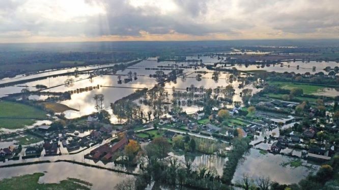
On television, we watched the desperate plight of the Fishlake victims as the emergency services worked to evacuate them. And, as we have seen so often in recent years, when survivors are able to return to their homes after a flood, what they are met with is a scene of complete devastation. Many find it hard to claim compensation, and insurance premiums rise relentlessly, as insurance companies are overwhelmed with claims.
In contrast to solutions of this kind, Ecological Owlthorpe promotes the preservation and conservation of upstream environments, an approach which is finding some favour in government circles. In an interview with Sophie Ridge in February 2020, George Eustace explained that the government’s approach to UK flood prevention would consist of an extra £4bn spending on flood defences but also in Yorkshire the creation and support of upstream nature-based solutions. In addition, as reported in a government press release on 23 January 2020, the Environment Agency, the Forestry Commission and Natural England have jointly committed to “nature-based solutions to tackle the climate emergency”, to which Ecological Owlthorpe has the potential to make an excellent contribution.
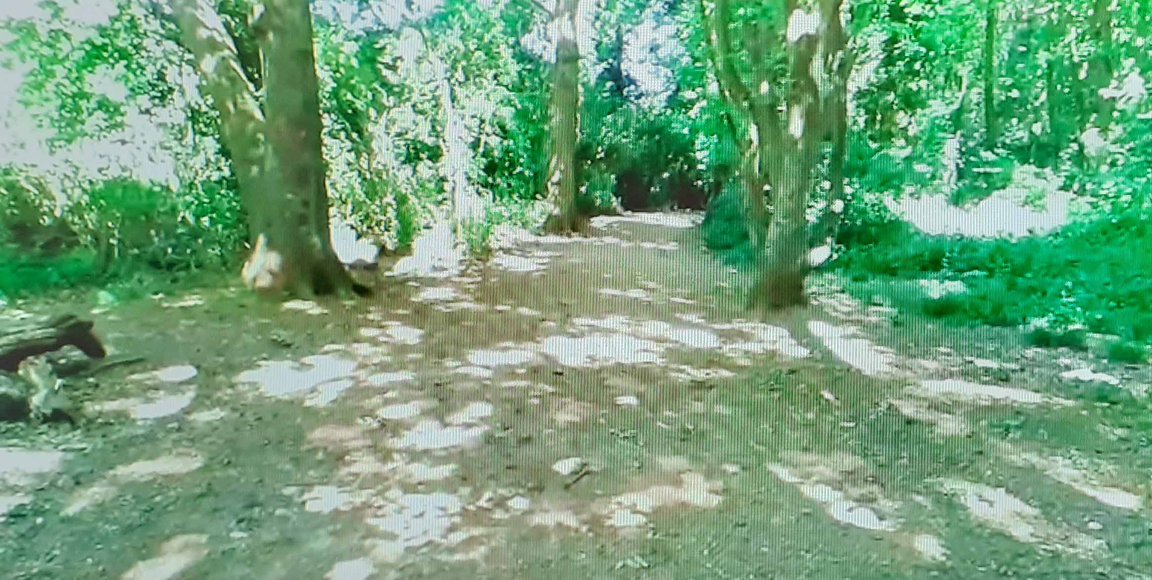
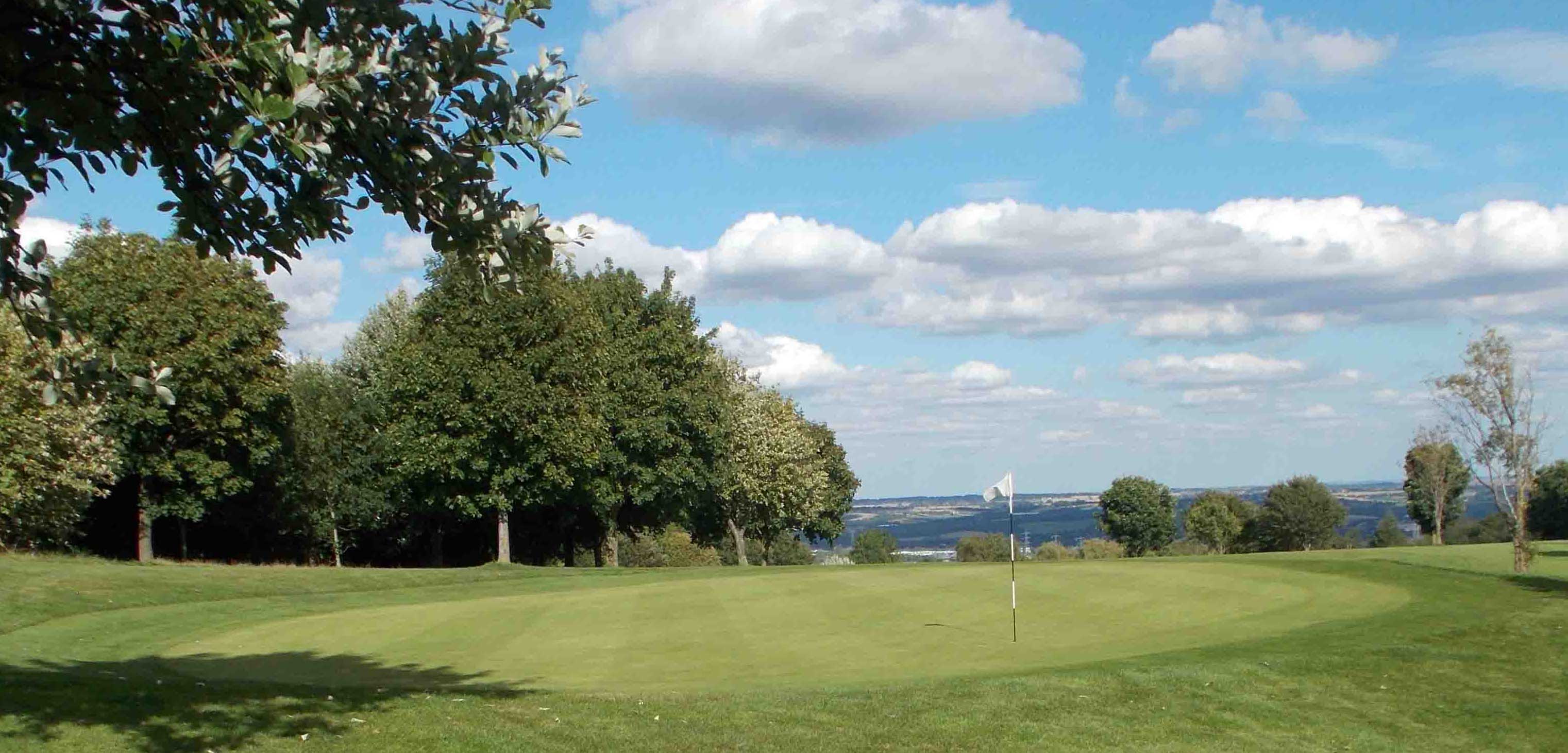
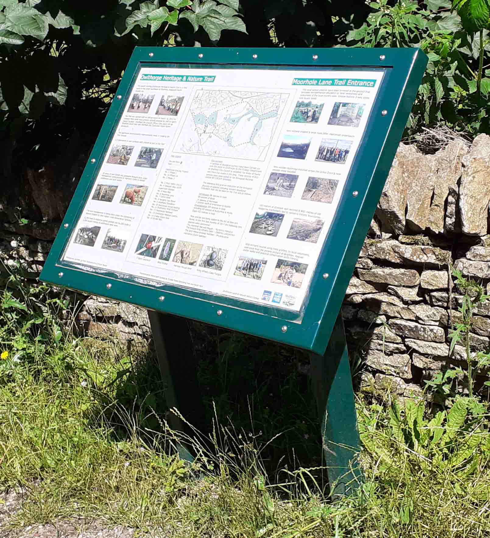
The ‘rural oasis’, as it has been termed, of Owlthorpe, which sits between Mosborough and Hackenthorpe, includes the award-winning Owlthorpe Heritage and Nature Trail, the Moorhole Lane Trail and other environmental and educational improvements which spread from Moor Valley down to Moss Way. Constructed with the help of some 795 local schoolchildren, the oasis was opened on 16 March 2012 by local MP Clive Betts. This is the area we wish to preserve as an upstream nature-based solution to protect the environment.
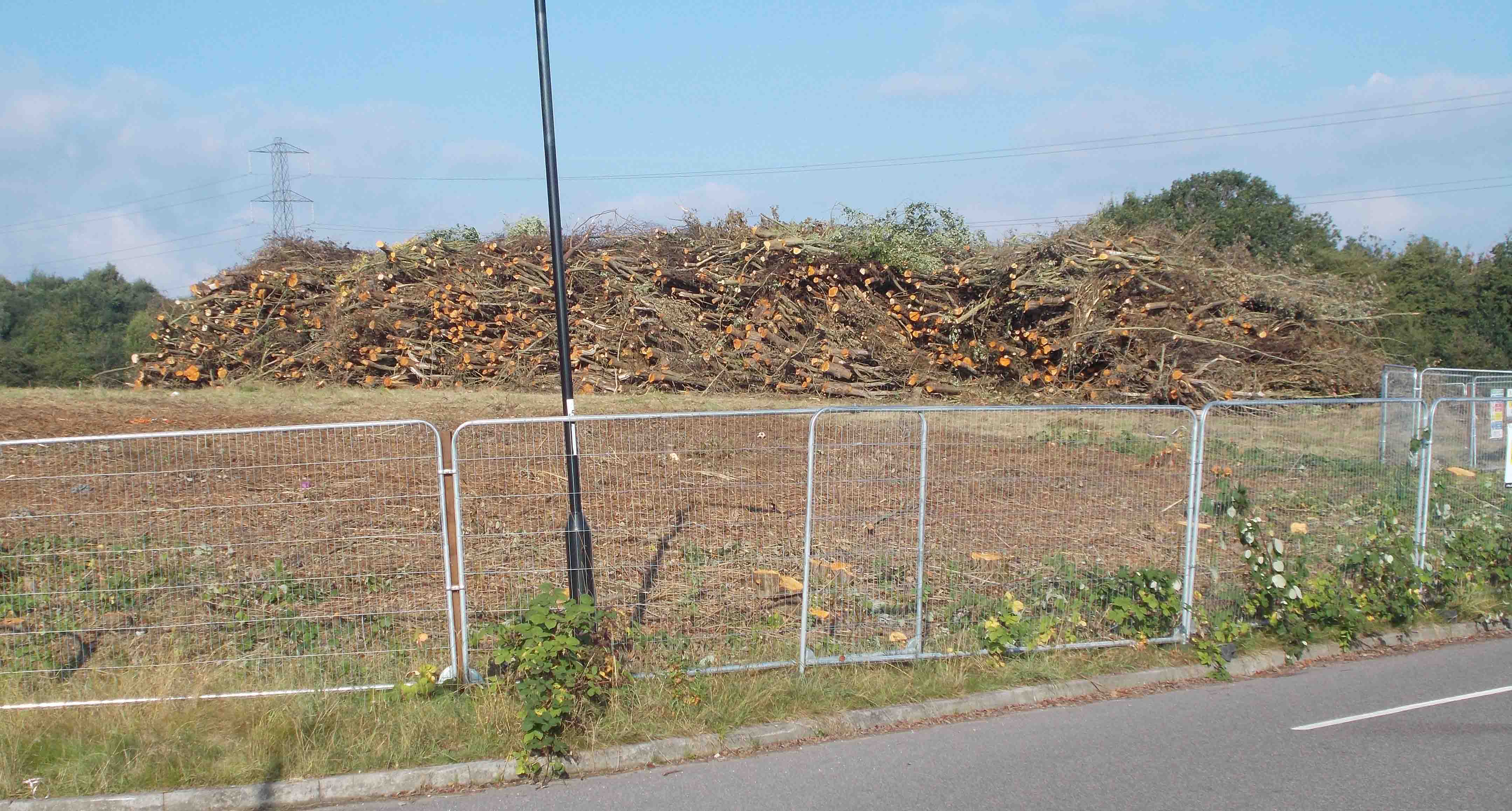
A further improvement to Ecological Owlthorpe’s capacity to control downstream flooding would be the planting of more trees. It is very much to be hoped that Sheffield local planning authority (LPA) will tap into the national tree strategy and that this will lead to the planting of trees upstream on all of Sheffield’s rivers.
While many came to the conclusion that the oasis should remain intact, as requested, they produced alternative plans to control the environmental impact, in case permission for the proposed development was granted. One suggestion was that the maximum number of properties on plot E should be not be 72, but 36. Taking action As we say on our website, public opinion is a very strong tool. It is by working together that we can change hearts and minds and curb the over-development of vital green spaces, especially when mature and valuable trees are threatened with the axe. Numbers are important: politicians take notice when they feel a sufficient threat to their re-election.
--------------------------------------------------------------------------------------------
Ironically, it was a previously constructed flood defence in Sheffield that contributed to the problem. Sheffield is a city with a history of damage to property and also loss of life caused by flooding, for example in 2007, when the River Don flooded the Don Valley area of the city, and a 14-year-old boy was swept away in the River Sheaf. To prevent further disasters, a concrete barrier was erected which did save the east of Sheffield from the 2019 winter floods, but instead caused floodwater to be channeled downstream towards Fishlake.
On television, we watched the desperate plight of the Fishlake victims as the emergency services worked to evacuate them. And, as we have seen so often in recent years, when survivors are able to return to their homes after a flood, what they are met with is a scene of complete devastation. Many find it hard to claim compensation, and insurance premiums rise relentlessly, as insurance companies are overwhelmed with claims. The ‘rural oasis’, as it has been termed, of Owlthorpe, which sits between Mosborough and Hackenthorpe, includes the award-winning Owlthorpe Heritage and Nature Trail, the Moorhole Lane Trail and other environmental and educational improvements which spread from Moor Valley down to Moss Way. Constructed with the help of some 795 local schoolchildren, the oasis was opened on 16 March 2012 by local MP Clive Betts. This is the area we wish to preserve as an upstream nature-based solution to protect the environment. The interpretation boards on our website show details of the extent of the work carried out under the management of Natural England under their higher level stewardship scheme, for example the creation of a wild orchard. Detailed invertebrate surveys carried out show the diversity of species living in Owlthorpe, and the natural ecology of the area. Some of the identified invertebrate species are dependent on the rare vegetation growing in Ecological Owlthorpe. These in turn are vital to the continued support of the area’s birds, and thus perpetuate the habitat naturally found in the area. During this past summer, it has been a pleasure to watch swifts darting after insects and buzzards hovering as they hunted for prey. The year 2020 has particularly highlighted the crucial need for green spaces such as this to be protected, for our own health and wellbeing and that of future generations.
Under the freedom of information act I have recived maps and payment structures from Rural Payments Agency Regarding Higher Level Stuardship Agreements between Sheffield City Council and Natural England from 2012 to 2022. The map below shows Owlthorpe Grassland & Grazing Project, and the impotrant areas of Maintance of Hedgerows, Ditches, Grassland and Wetlands that are of very high environmental Value. Click here to see a map showing what is at stake:
A further improvement to Ecological Owlthorpe’s capacity to control downstream flooding would be the planting of more trees. It is very much to be hoped that Sheffield local planning authority (LPA) will tap into the national tree strategy and that this will lead to the planting of trees upstream on all of Sheffield’s rivers. Competing demands on Owlthorpe We all want to live in an environmentally friendly world free from pollution, floods, disease, famine and war. Politicians from all political parties claim to want the same and have signed up to ecological and climate emergency policies. For the sake of Ecological Owlthorpe and all other such fundamentally important environmental initiatives, let’s see if we can hold them to it.
Deforestation of trees on site E is not the way to prevent downstream flooding. Published 2nd February 2023 Natural England unveils new Green Infrastructure Fraimework. "Natural England's commitment is that the public should be able to access green space or water,such as woodlands, wetlands, parks and rivers, within a 15-minute walk from their home." Taking action As we say on our website, public opinion is a very strong tool. It is by working together that we can change hearts and minds and curb the over-development of vital green spaces, especially when mature and valuable trees are threatened with the axe. Numbers are important: politicians take notice when they feel a sufficient threat to their re-election. History of our endeavours to save Ecological Owlthorpe Dated: 2nd December 2024, review of the https://www.ecological-owlthorpe.org project.
Editorial: Working with nature: Sheffield campaign calls for protection of upstream environments https://www.ecological-owlthorpe.org/EO-02EcologicalOwlthorpeanenvironmentalapproach.pdf To promote our project, we have built this we-site: https://www.ecological-owlthorpe.org/index.html we have also posted many posts on face-book: https://www.ecological-owlthorpe.org/FacebookPosts.htm we have started a petition to Sheffield City Council: Save Ecological Owlthorpe we have also produced a visitor’s Guide to Ecological Owlthorpe: Welcome to our on-line Visitor's Guide to Friends of Ecological Owlthorpe An extra £4 Billion to be spent on flood defences up stream nature-based solutions are to be supported. We have asked many questions of the Coal Authority and the Environment agency regarding the flooded mines that run under Owlthorpe. Questions and Answers can be seen hear:
https://www.ecologicalowlthorpe.org/LettertoCoalAthority.pdf Dated: 26th May 2020. Call in request to George Eustace MP Secretary of State for Environment, Food and Rural Affairs: https://www.ecological-owlthorpe.org/Email26thMay2020GeorgeEustace.pdf Dated: 2nd June 2020. Review of Planning and Highways Committee Meeting. Video evidence is available if required. Date: Inquiry Held on 12-15, 19, and 21 January 2021 Site visit made on 20 January 2021 by O S Woodwards BA(Hons.) MA MRTPI an Inspector appointed by the Secretary of State. Video evidence is available if required. Evidence: Regarding Secretary of State Environment. Evidence: Regarding Planning Inspectorate. Evidence: Regarding Parliamentary Ombudsman. Evidence: Regarding Secretary of State Housing. Evidence: Regarding Natural England. Evidence: Regarding the Environment Agency. Evidence: Regarding Coal Authority. Evidence: Regarding Cola Mining in Owlthorpe. Evidence: Regarding Sheffield (LPA). Evidence: Regarding the Ochre Dyke. 2nd December 2024: https://www.bbc.co.uk/news/articles/cx2wk803r17o
Planning Objections to building on plot E Owlthorpe Planning Objections to building on plot F Owlthorpe Our project is now under threat from Sheffield City Council (LPA) who wish to build 150 new properties on (plot F) the Grassland & Grazing Project situated on Owlthorpe Heritage & Nature Trail, a major component of Ecological Owlthorpe. We decided to take action and started a petition Please help our project by signing our petition to Sheffield City Council: https://chng.it/6vXHqcGG4S thank you to those who have signed. Please Shair with Friends and Family. Thank you for your support Michael Meredith
|
|
There are a number of organisations which can help with identification of flora and fauna that you may find in Ecological Owlthorpe. Here are one or two web-sites you may find helpful. https://www.wildsheffield.com/wildlife/wildlife-in-sheffield-and-rotherham https://www.woodlandtrust.org.uk/trees-woods-and-wildlife/identify-wildlife/ https://www.wildlifetrusts.org/ https://www.wildsheffield.com/ https://www.rspb.org.uk/birds-and-wildlife/wildlife-guides/identify-a-bird/ https://nbn.org.uk/biological-recording-scheme/sheffield-biological-records-centre/
|
|


E-Mail: ecologicalowlthorpe@gmail.com
Facebook: https://www.facebook.com/people/Ecological-Owlthorpe/100064743398782/